Michigan Highway 142 is an east-west highway on the "Thumb" of Michigan, sandwiched between Saginaw Bay and the portion of Lake Huron's main body lying to the east. Both ends of Michigan Highway 142 are at Michigan Highway 25, the state highway tracing the outline of the "Thumb". The piece of land situated here has a shoreline shaped like a dome or arch, and Michigan Highway 142 cuts an east-west chord across that arch shape. Michigan Highway 142's western end is a mile south of the small town of Bay Port, or five miles west of Pigeon. Michigan Highway 142 heads east through Pigeon from that spot, setting out to pass through Elkton and Bad Axe as well. The eastern end of Michigan Highway 142 is at Michigan Highway 25, just like the western end. The junction here at the eastern end lies in Harbor Beach, a town on the western shore of Lake Huron's main body.
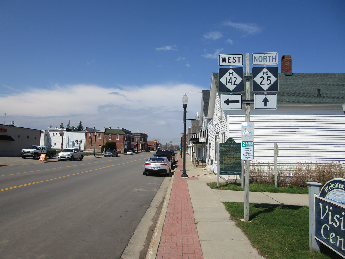
My photo for Michigan Highway 142 signage comes from Harbor Beach, at the eastern end of that route. Travelers heading northerly on Michigan Highway 25 will see this sign in Harbor Beach, indicating the turnoff to Michigan Highway 142's eastern beginning. This photo was taken in April 2021, along the trip across Metro Detroit and the Michigan Thumb.
Back to the Michigan main page.
Back to the home page.
Back to the Michigan main page.
Back to the home page.
