Ohio State Route 501 begins in Wapakoneta and runs straight north to the western outskirts of Lima. This route exists where northwestern Ohio meets west-central Ohio. The southern point of beginning is an interchange with US Route 33's freeway on the south side of Wapakoneta. This southern point of beginning is shared with not one, but two other routes: Ohio Route 67 and Ohio Route 198. At the center of Wapakoneta, Ohio Route 67 breaks off and does its own thing toward the northeast, and north of town, Ohio Route 198 splits from Ohio Route 501 to continue northwesterly. That leaves Ohio Route 501 all on its lonesome to serve travelers looking for a route straight toward the north. Ohio Route 501 only serves those travelers for about another ten miles north of town. This is because the route ends at Ohio Route 117, on the western reaches of the Lima area.
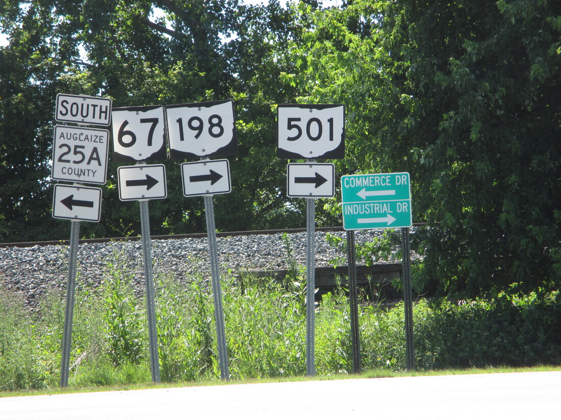
My photo of Ohio Route 501 signage comes from the southern end, at US Route 33. This southern end, as previously states, is shared with the southern ends of Ohio Routes 67 and 198. The three routes run along a former alignment of US Route 25 that is right along the east side of a railroad. For that reason, the interchange at US Route 33 is a folded diamond interchange, with all of its ramps on the east side of the surface road that carries the state highways north from there. The drivers exiting the westbound side of US Route 33 will see the set of signs in the photo, pointing out that all three state highways begin with a turn to the right (north). This photo was taken in June 2016, as I was taking US Route 33 toward Columbus.
Back to Ohio Routes 500-599.
Back to the Ohio main page.
Back to the home page.
Back to Ohio Routes 500-599.
Back to the Ohio main page.
Back to the home page.
